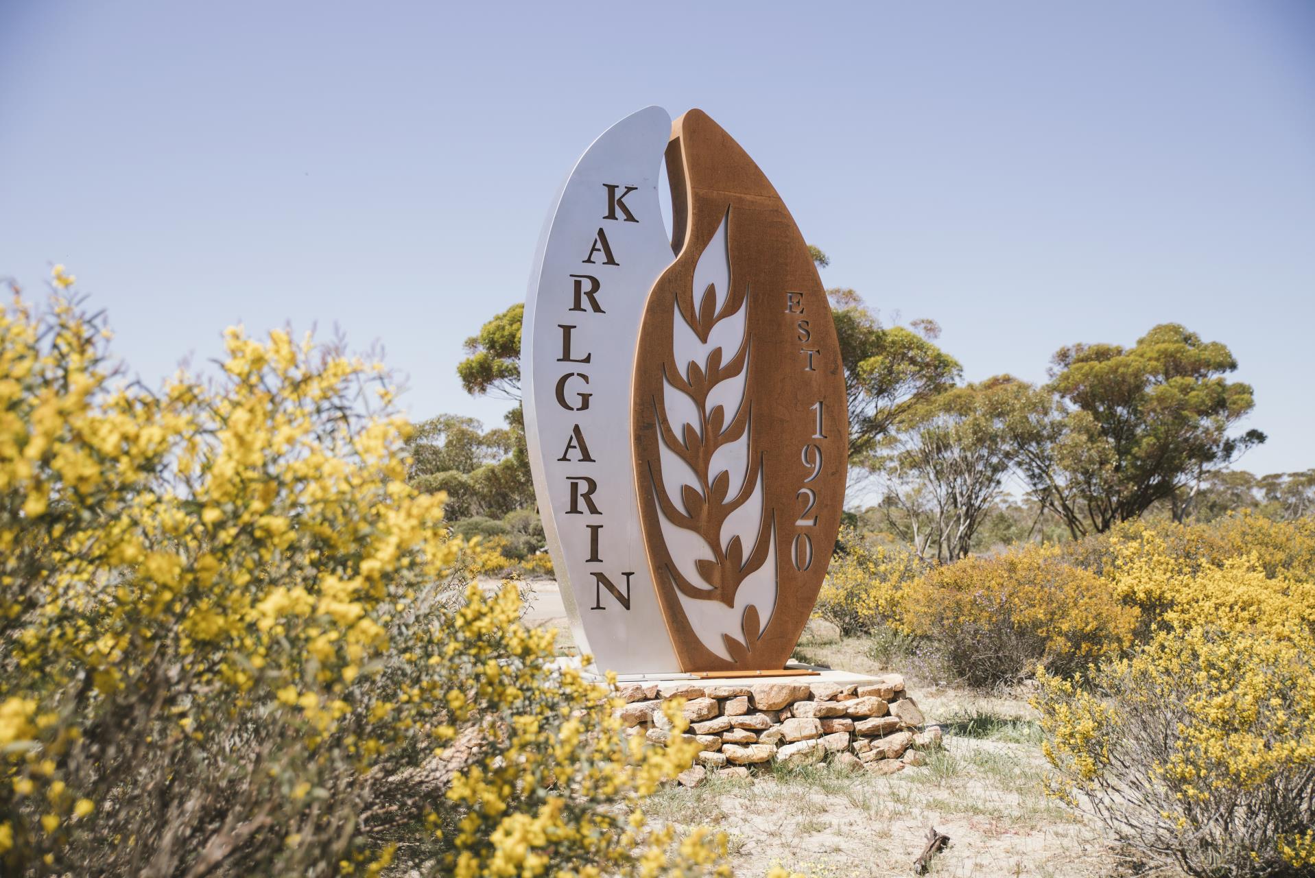
Welcome to Karlgarin
Karlgarin is a small and proud Wheatbelt town to a community of 93 people. Karlgarin is a town located 321 kilometres southeast of Perth in the eastern Wheatbelt region of Western Australia. A small traditional farming town, most of the farmers trade in sheep, cattle, wheat, oat, canola, barley and lupins.
The first European to visit the area was Surveyor-General John Septimus Roe, who passed through in 1848. 'Carlgarin' was the original name Roe gave the district, now spelled with a K, which is said to come from the Noongar language. "Karl" is the Noongar word for fire. Karlgarin was selected as a soldier settlement site and a declaration of a townsite was sought in 1924. By 1929 there were about 200 settlers in the district. It was not until 1930 that the railway came to the area. The townsite was gazetted in 1931.
The main hub of the community is the Karlgarin Country Club, established in 1953. Located on Foundation Street, the Country Club only opens Thursdays and Friday nights and sells food and a range of drinks. In 2015 Karlgarin welcomed a new cafe and art gallery at the old CWA building. Pamela Jay Expressions is open Sundays and public holidays.
Other facilities offered in Karlgarin include the Church of Our Lady Help of Christians Catholic Church Karlgarin. The church's foundation stone was laid by Rev. Myles McKeon on 13 March 1966.
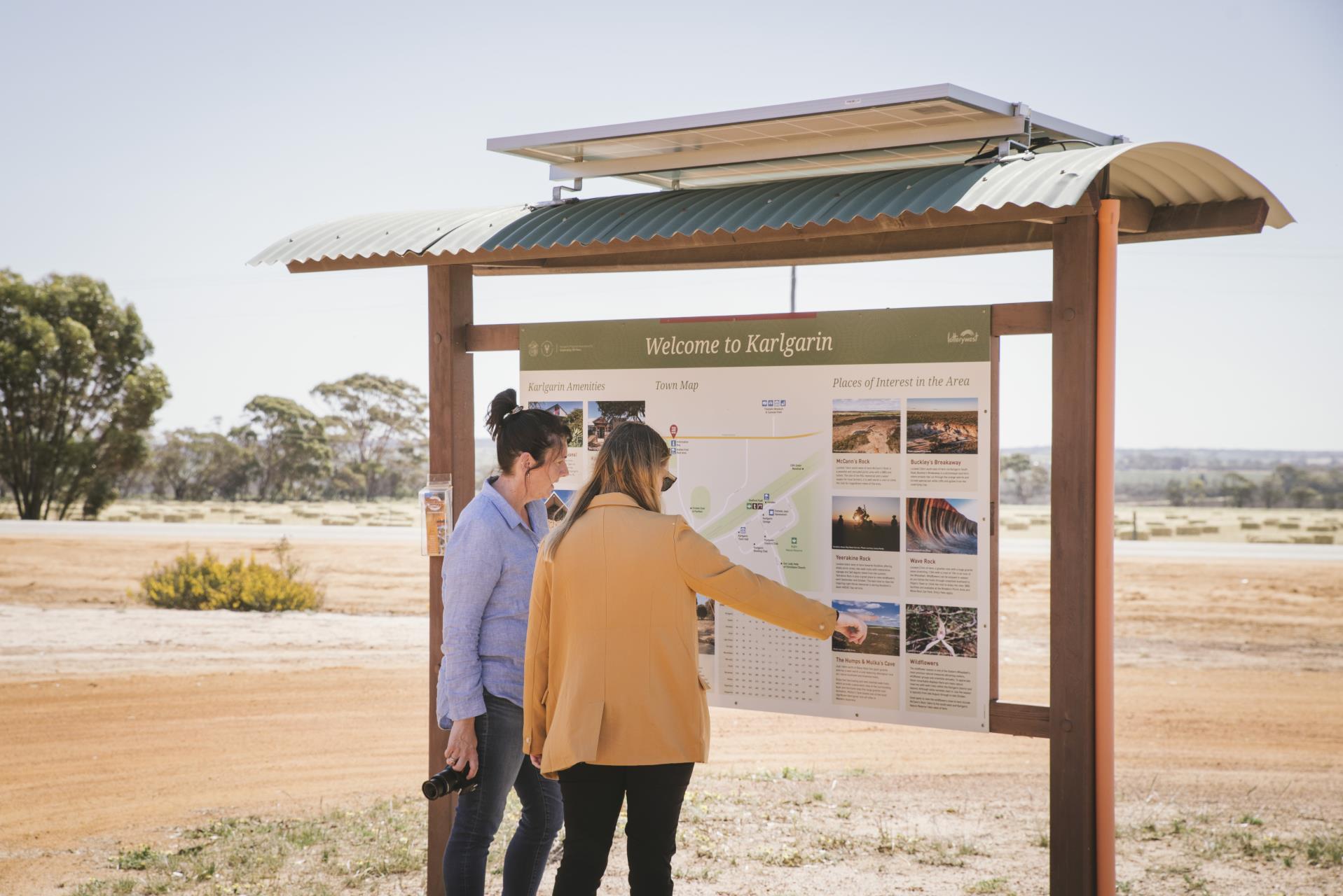
Shire of Kondinin Town Maps
Hyden & Karlgarin Community Profile
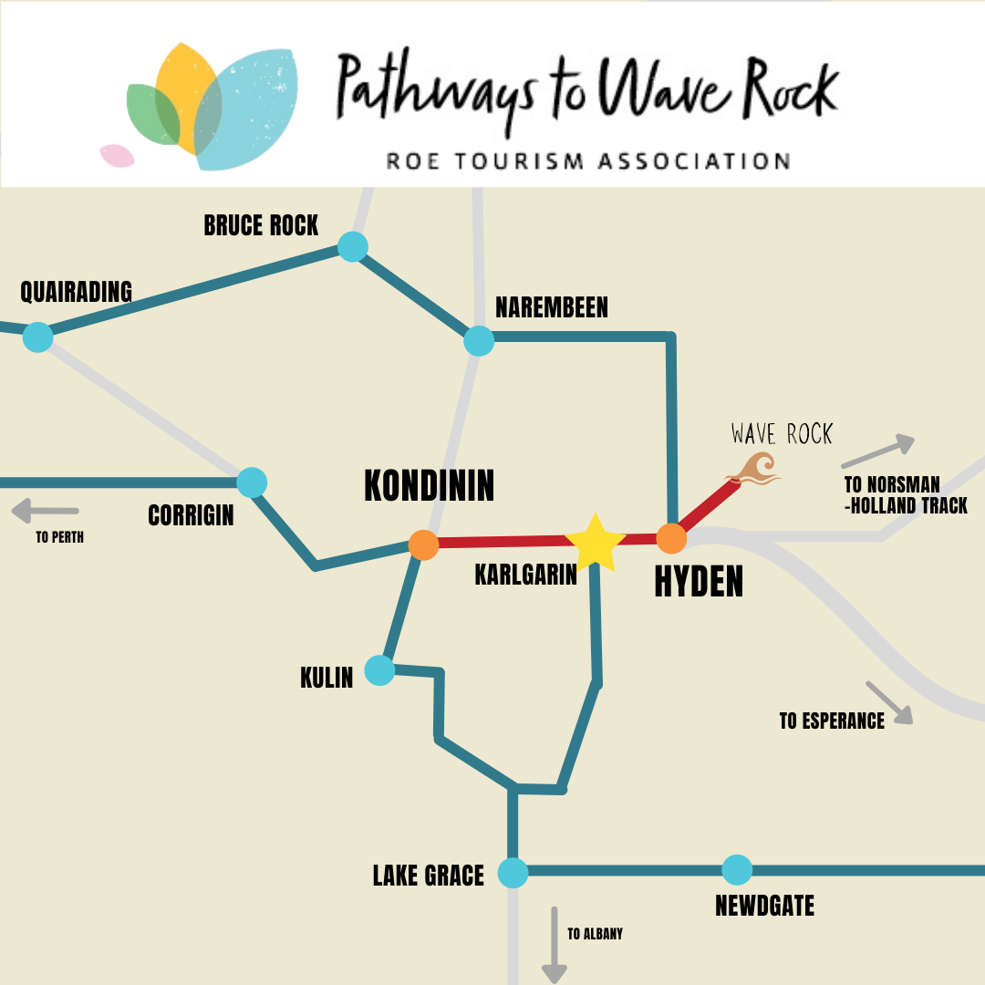
Pathways to Wave Rock
The township of Kondinin provides the perfect base to explore the Pathways to Wave Rock Drive Trail.
The Pathways to Wave Rock is a self-drive trail offering a range of unique Wheatbelt experiences and linking the Shires of Bruce Rock, Corrigin, Kondinin (Karlgarin & Hyden), Kulin, Lake Grace, Narembeen and Quairading.
From massive granite outcrops to spectacular views, vibrant wildflowers and true country hospitality, this trail offers a range of unique experiences across the region. Easy day trips can be made to many of the region's unique and iconic sights including Wave Rock. For more information go to the Roe Tourism (Path Ways to Wave Rock) website. http://www.roetourism.com.au/
Pathways to Wave Rock Brochure
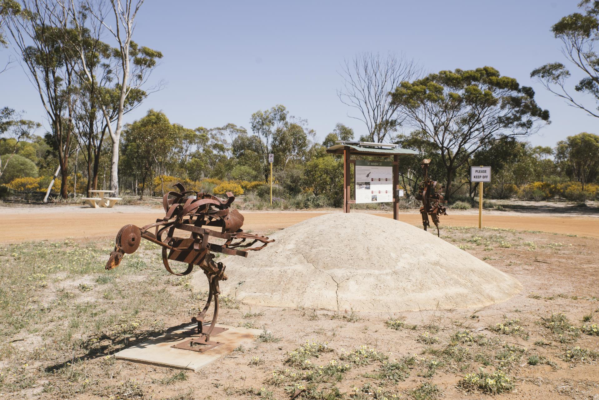
Malleefowl Travel Stop
The Malleefowl Travel Stop is along the highway between Kondinin to Hyden, located at the turn off to Karlgarin. The Malleefowl sculptures were created by local residents Merv Trestrail and Colin Richter as part of a community arts project.
Malleefowls are known to nest around the town ship of Karlgarin and around McCann's Rock.
Images by Angie Roe Photography
Stafford Park
The delightful rest area featuring old farm machinery, seating made from local Karlgarin Speckled Granite, a small park, unique artwork, settler's garden, and historic information including maps, photographs, and stories of the Karlgarin district since 1920.
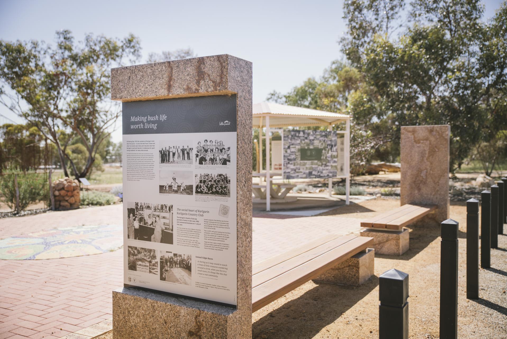
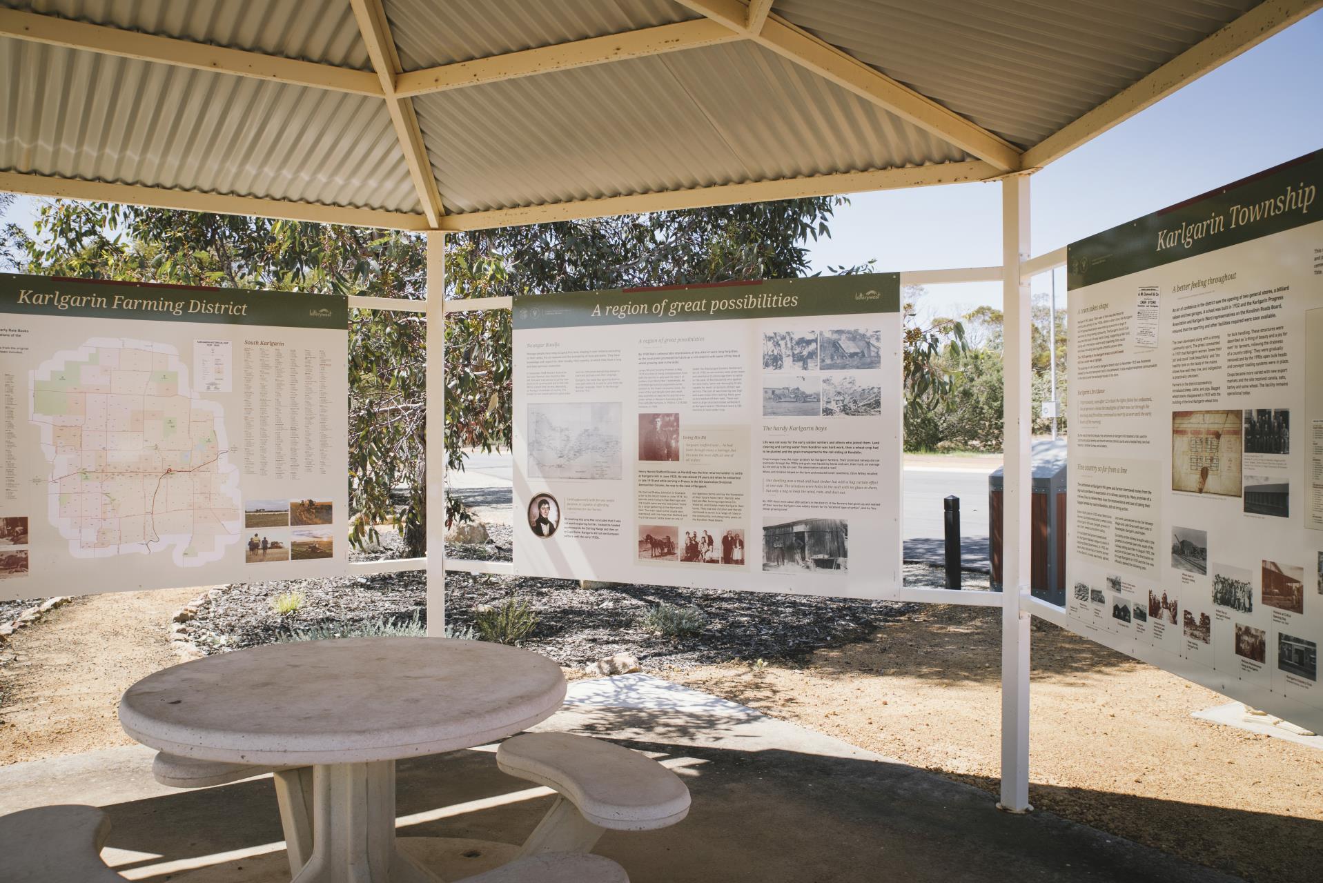
Images by Angie Roe Photography
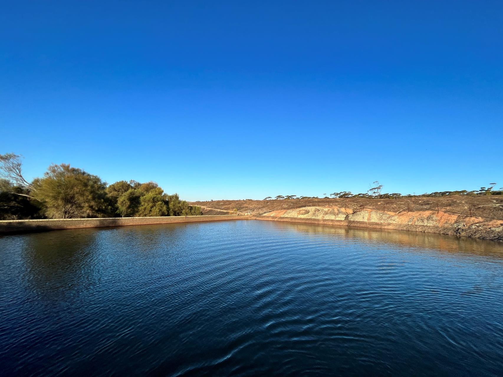
McCann's Rock
Located 16km southwest of Karlgarin. McCann's Rock is a peaceful and secluded picnic area with a BBQ and toilets.
The site of the RSL memorial and water supply for the local farmer's.
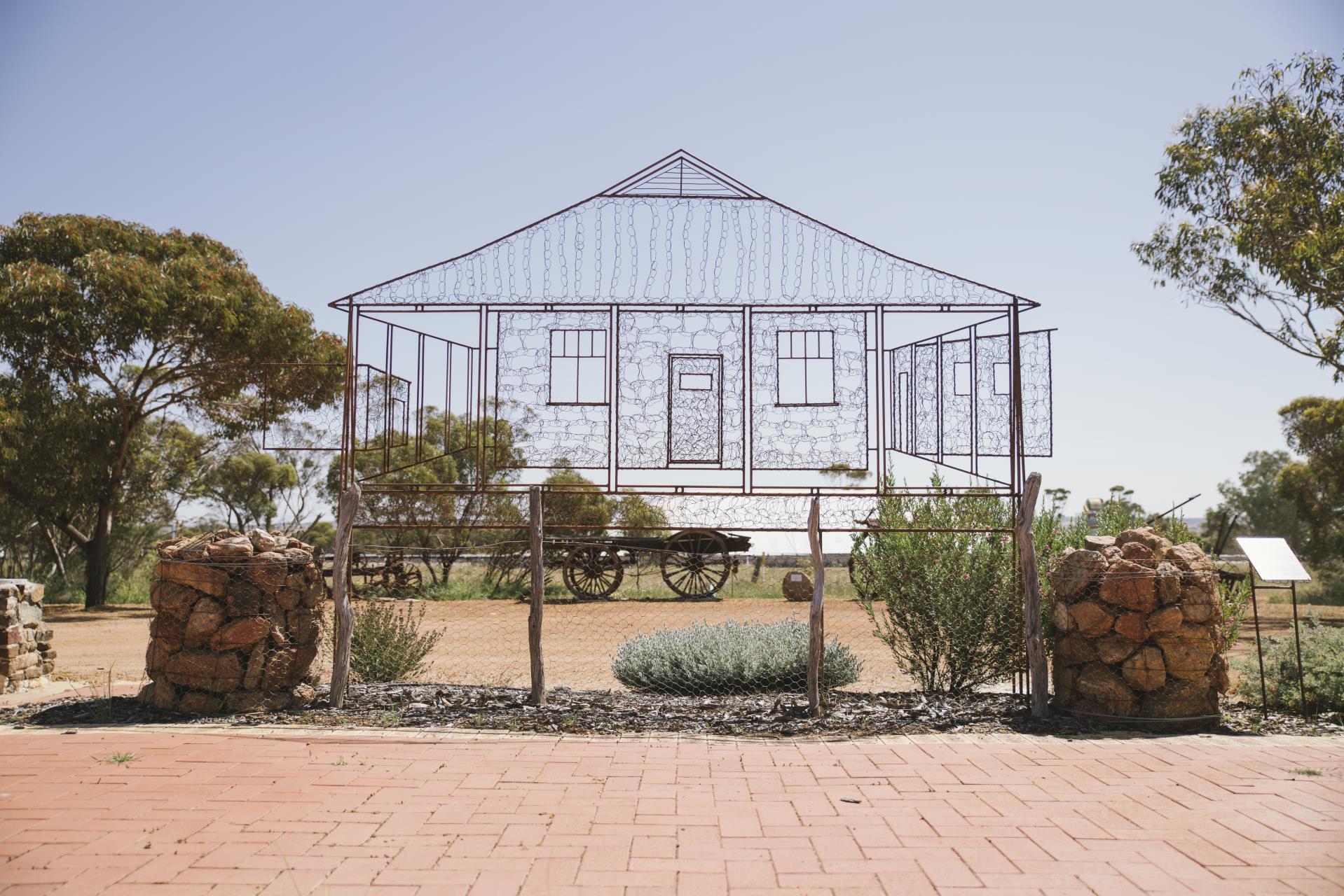
Art Trail
The art trail in Karlgarin recognises and celebrates the creativity across Karlgarin. There are heaps of different types of artwork from sculptures to murals.
Shire of Kondinin Art Trail - Front & Back
Shire of Kondinin Art Trail - Inside
For more information please contact us